Nevada Bureau of Mines and Geology’s regional-scale lidar mapping provides novel insights into earthquake, flood and glacial history
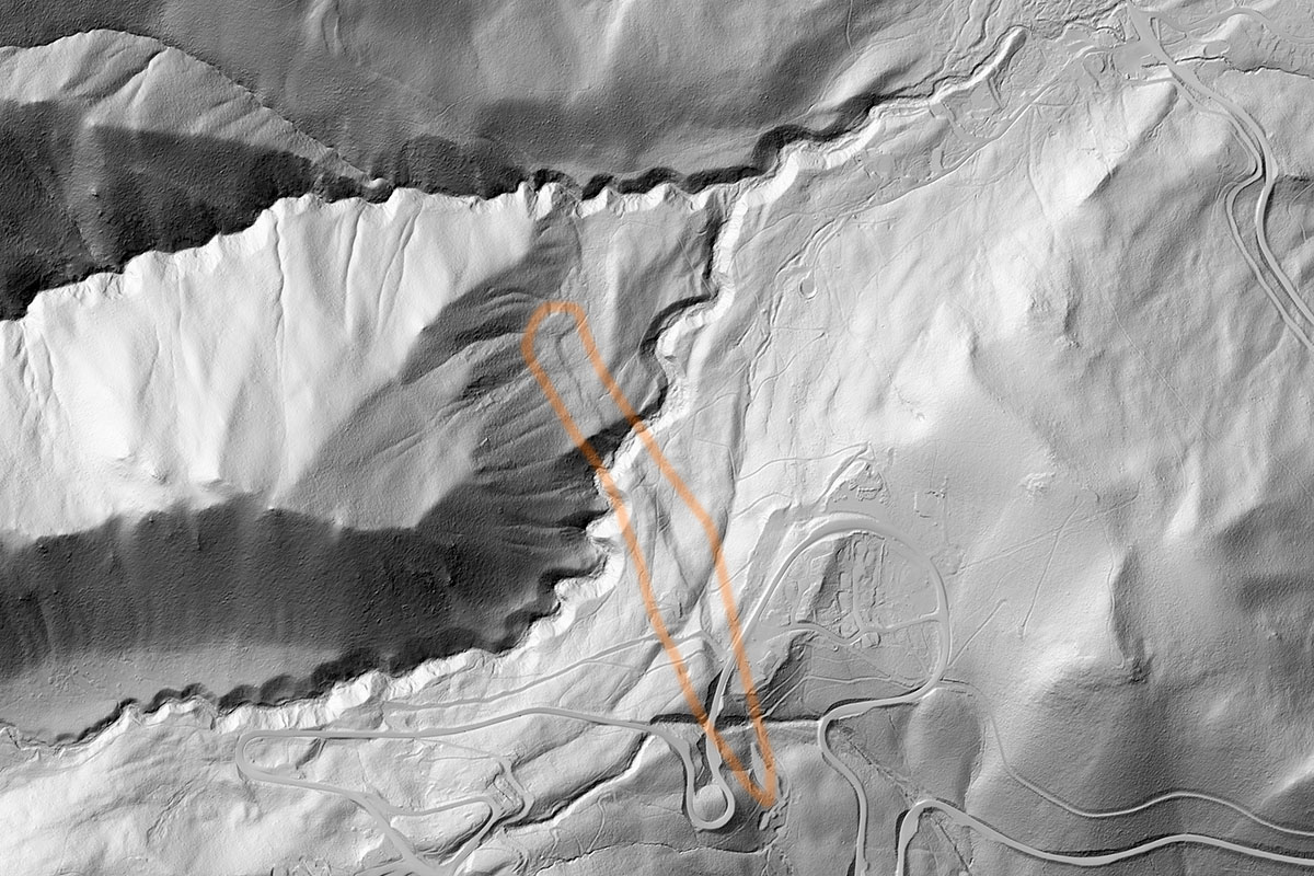 |
| Galena fault scarp located near Steamboat Springs south of Reno |
The project utilized airborne lidar technology to produce high-resolution topographic maps of the Reno-Sparks-Carson City area. The data will benefit a number of in-progress Nevada Bureau of Mines and Geology studies to understand earthquake and flood hazards, as well as natural resources.
Using Light Detection and Ranging technology, or lidar, the project collected data by bouncing light pulses off the surface of the earth. The result is a high-resolution, three-dimensional topographic map that allows improved identification of geologic features such as flood plains, glacial deposits and earthquake faults. This can also support the assessment of ecological systems, infrastructure planning and the identification of geothermal reserves to support clean-energy production.
The Nevada Bureau of Mines and Geology created an online story map, titled Reno’s Bare Earth: Below the Neon, to document the project and share examples of lidar images. Visit the story map at unr.edu/nbmg/bare-earth.
Read More.........