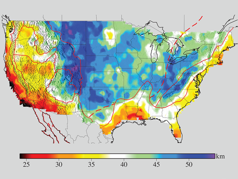
USArray data to expose a wealth of noteworthy crustal and upper mantle structures, including previously unknown anomalies beneath the Appalachians.
The new model also reveals some previously unknown features that warrant further study, including three relatively low velocity areas in the upper mantle beneath the Appalachians—one centered beneath northern Georgia, a second below the Blue Ridge Mountains in western Virginia—and an especially prominent anomaly beneath New England’s White and Green Mountains. Intriguingly, both the Virginia and New England anomalies are confined to the shallow mantle above 80 kilometers depth and are areas that previous research has tentatively linked to a Cretaceous hot spot track.
(Thanks to GRC Member Marcelo Lippmann, Staff Scientist (retired) at Lawrence Berkeley National Laboratory for the submission.)
